Proposed Traffic Calming measures and footpath enhancements on N62 relating to O’Donovan Rossa Street, formerly ‘Pudding Lane’ or ‘Jail Street’.

Quoting from the AECOM report: “The existing conditions on O’Donovan Rossa Street include footpaths with widths ranging from 0.7m at the intersection with Liberty Square to 5m outside the Courthouse. There are no pedestrian crossing facilities on this stretch of road*. The carriageway ranges in width from 5m – 7m, and the road changes from two-way to one-way at an unmarked location outside the Courthouse. There is 145m of on-street pay and display parking.
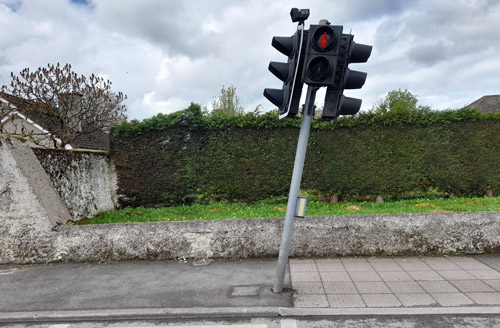
* Well actually there is one signalised pedestrian crossing on this road, positioned outside the Ursuline Convent, which our planners have failed to identify. Yes, it has a bent set of lights staring into the ground, which was reported 15 months ago, on April 30th, 2023, and which has not been repaired to this date, despite being used by students attending the two secondary schools in the area. See image hereunder.
Quoting from the AECOM report: “Due to the high numbers of HGVs in the study area there are a number of safety concerns for pedestrians. The primary safety concern relates to the lack of pedestrian crossing between the central island car park and the footpaths on the periphery of the Square. This causes members of the public to jaywalk across two lanes of live traffic. This has led to a number of collisions and fatalities in recent years. There was a fatal collision on the northern side of the Square in Autumn 2023, involving a pedestrian being struck by an HGV.
The presence of HGVs on narrow roads, particularly O’Donovan Rossa Street, is a risk to safety. Many areas have narrow footpaths, therefore when large spills of pedestrians occur, this can force pedestrians on to the road with live traffic.
It is proposed to introduce a raised uncontrolled pedestrian crossing at the junction of Liberty Square and O’Donovan Ross Street. The crossing will include tactile paving for visually impaired pedestrians. North of this crossing, high end paving is proposed for the footpath surface on both sides of the street from the junction with Liberty Square to the Credit Union building.
It is proposed to widen the western side footpath at various sections along the street. This would include significant widening of the footpath in front of the vehicular entrance to The Premier (Hall) and along the section between the Court House and the Fire Station, including the introduction of landscape areas. It is proposed to introduce a bus stop on the eastern side of the road in front of the fire station and a landscaped area between the Fire Station and the Court House.
The landscaped areas will include SUDS* features such as rain gardens where possible. There is a proposed uncontrolled crossing located outside the courthouse”.
*[ SuDS – Sustainable Drainage or SuDS is a way of managing rainfall that minimises the negative impacts on the quantity and quality of run-off whilst maximising the benefits of amenity and biodiversity for people and the environment].
Quoting from the AECOM report: “It is proposed to limit traffic flow to a one-way system so there will be no Northbound traffic permitted beyond the junction with Cuchulain road.”
Quote from Phase 1 Report: “It is proposed to limit traffic flow to a one way, with no vehicles permitted entry to Cuchulain Road at the junction with O’Donovan Rossa Street.”
Locals will be aware of this folly and the bottleneck that will be caused when motorists exit Liberty Square into Parnell Street and turn into Cuchulain Road, (latter now proposed as one way), then at the Cuchulain Road junction, joining O’Donovan Rossa Street, discover no Northbound traffic is permitted, before exiting once again unto Liberty Square, thus completing a full circle.
This will provide clarity that the street is now operating under a one-way system, eliminating confusion over the informal two-way system that the street currently operates under. This junction is proposed to have a raised table and corner radii tightened through the widening of footpaths at these corners. High end paving is proposed on the footpaths at this junction.
These measures are proposed to provide a safer pedestrian experience trough wider footpaths and segregation from traffic through the use of landscaping. The formalised bus stop provides a safer location for passengers, particularly school children attending the schools on the R498 and Brittas Road, to alight while also not obstructing the flow of traffic. O’Donovan Rossa Steet also has proposed planting at the northern end of the scheme. These planted areas are identified for potential SuDS interventions, as they may be suitable rain garden locations similar to those proposed on Kickham Street as part
of the N75 Improvement Scheme, subject to detailed design.
- Along the western side of O’Donovan Rossa Street, 15m (50ft approx. or 4 car parking spaces) of on-street parking is being removed to allow for footpath widening and provision of SUDs measures.
- Along the eastern side of O’Donovan Rossa Street, 4 car parking spaces are being removed to facilitate the introduction of a bus stop.
With a 48 seater bus averaging in size of 12m (40ft approx.) and the 4 car parking spaces to be removed measuring 15m (50ft); one must ask where will the other 3 school buses serving the needs of the CBS secondary pupils now park.In our report of July 22nd found HERE and entitled “Proposed Liberty Square Layout Phase 2”, our readers will be aware of a loss of 19 car parking spaces, including a Taxi Rank, under this new proposed, long overdue, Phase 2 upgrade.
This 19 car parking spaces to be lost in Liberty Square, when added to the 21 car parking spaces, due to be axed on Parnell Street, and the latest 8 car parking spaces reported above on O’Donovan Rossa Street, we now calculate the removal in total of 48 now lost/removed spaces.
This figure calculated, immediately calls into question the figures supplied by the authors of this poorly prepared report, which they claim is a net gain of 30 spaces. [50-48 = 2].
Again where these extra promised 50 car parking spaces are be provided ‘northwest of the Liberty Square car park’ remains a secret to myself and to most other residents of Thurles. It has been suggested that an announcement by councillors of the purchase of a new field, ‘is currently being muted’.
Did Tipperary Co. Council actually pay for this planning report?


Leave a Reply